A visit to Washington’s Ohio: Our river has changed greatly since 1770
-

- A barge makes it way upstream past Marietta. (Photo by Art Smith)
-
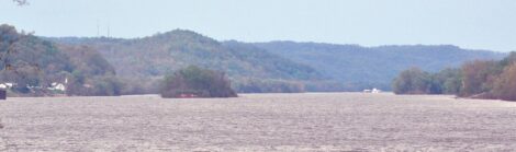
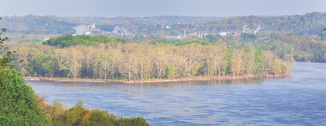
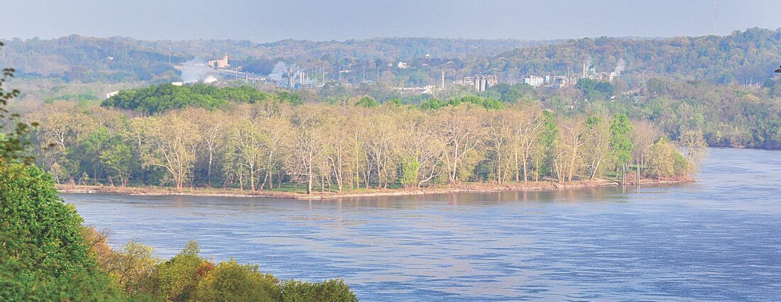
- A section of the Ohio River above Newport that Washington called the “long reach.” (Photo by Art Smith)
-
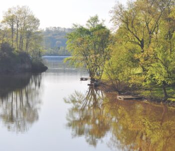
- Trees reflect in the Little Hocking near the confluence with the Ohio River. (Photo by Art Smith)
-

- Geese stand on an old log along the river downstream of Little Hocking. (Photo by Art Smith)
-
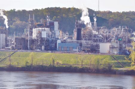
- The large industrial complex built by DuPont in Washington, W.Va. (Photo by Art Smith)
-
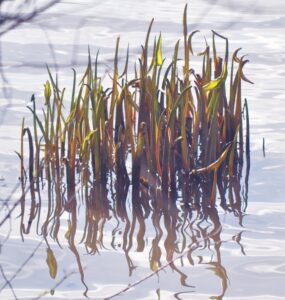
- Grass reflects in the water along the bank of the Ohio River near Little Hocking. (Photo by Art Smith)
-
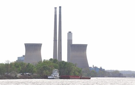
- The large power plant along the river at Willow Island near Newport is one of many located along the river. (Photo by Art Smith)
-
- Blennerhassett Island, which in 1770 was a series of smaller islands, is now a state park. (Photo by Art Smith)
-

- A monument to Dr. James Craik, who travel with Washington, is near Belleville, W.Va. (Photo by Art Smith)
-

- The Belleville Dam and others keep the Ohio River navigable by maintaining a minimum pool level. (Photo by Art Smith)
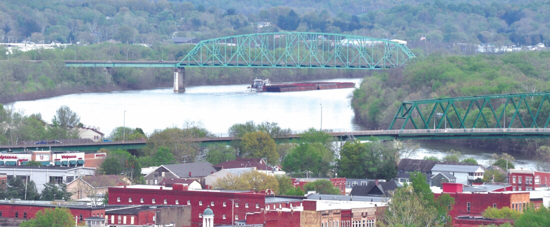
A barge makes it way upstream past Marietta. (Photo by Art Smith)
In October 1770 George Washington began a survey of the Ohio River valley. He made the trip with his friend, Dr. James Craik, and several others so he could view the lands that he earned for his service in the French and Indian War.
His diary provides an interesting view of the Ohio River as it once was. Comparing his notes, the river has transitioned over the last 254 years to the industrial artery that it is today.
The future president owned a tremendous amount of land including 9,744 acres on the Ohio River and another 23,341 acres on the “Great Kenhawa” He also owned 234 acres in Pennsylvania, 3,051 acres in the Northwest Territory, and 5,000 acres in Kentucky. When he died in 1799 he owned 52,195 acres.
The Ohio River today has been raised with giant locks and dams to give commercial traffic enough water to operate year-round and is crossed by dozens of bridges connecting cities that did not exist in 1770. The riverbanks, filled with trees in 1770, is now lined in many places by heavy industry. His diary included the following entries as he passed down river. He had started near Pittsburgh on Oct. 20.
George Washington: Oct. 26, 1770: “Left our encampment at half an hour after six o’clock, and passed a small run on the west side about four miles lower. At the lower end of the Long Reach, and for some distance up it, on the east side, is a large bottom, but low, and covered with beech near the river-shore, which is no indication of good land. The Long Reach is a straight course of the river for about eighteen or twenty miles, which appears the more extraordinary as the Ohio in general is remarkably crooked. There are several islands in this reach, some containing an hundred or more acres of land; but all I apprehend liable to be overflowed.”

A section of the Ohio River above Newport that Washington called the “long reach.” (Photo by Art Smith)
(This is the area between New Matamoras and Newport. Much of the land on the Ohio side is undeveloped portions of the Wayne National Forest.)
G.W.: “At the end of this reach we found Martin and Lindsay, two traders, and from them learnt, that the person drowned was one Philips, attempting, in company with Rogers, another Indian trader, to swim the river with their horses at an improper place; Rogers himself narrowly escaping. Five miles lower down comes in a large creek from the east, right against an island of good land, at least a mile or two in length”.
(This would be Middle Island. The large Island is now part of the Ohio River Island Nature Preserve. It is the only island on the river that you can get to by car. Using part of the former St. Marys-Newport Bridge, you can drive to, and park on the island. It has a number of trails for day use. Of all the island in the preserve, it is the most developed. The 77-mile Middle Island Creek forms at the confluence of Meathouse Fork and Buckeye Creek at Smithburg in Doddridge County and passes through Tyler and Pleasants counties before reaching the Ohio River.)
G.W.: “At the mouth of this creek, the name of which I could not learn, except that it was called by some Ball’s Creek, from one Ball that hunted on it, is a bottom of good land, though rather too much mixed with beech. Opposite to this island the Indians showed us a buffalo’s path, the tracks of which we saw.”
(This would be Newport.)

Trees reflect in the Little Hocking near the confluence with the Ohio River. (Photo by Art Smith)
G.W.: “Five or six miles below the last mentioned creek we came to the Three Islands. Below these islands is a large body of flat land, with a watercourse running through it on the east side, and the hills back neither so high nor steep in appearance, as they are up the river. On the other hand, the bottoms do not appear so rich, though much longer and wider. The bottom last mentioned is upon a straight reach of the river, I suppose six or eight miles in length.”
(The islands would have been Broadback, Eureka and Willow islands. Willow Island exists today in name only, having been absorbed by the construction in 1967 of the Willow Island Lock and Dam and the construction of the large coal fired power plant nearby.)
G.W.: “About twelve miles below the Three Islands we encamped, just above the mouth of the creek, which appears pretty large at the mouth, and just above an island.”
(This would have been the Little Muskingum, the location of his camp would be roughly behind the ParMar store along Ohio 7 in Reno. The Little Muskingum weaves its way northeast through Washington County passing under three covered bridges on its way to Monroe County. Washington County was named for the general.)
G.W.: “All the lands from a little below the creek, which I have distinguished by the name of Ball’s Creek, appear to be level, with some small hillocks intermixed, as far as we could see into the country. We met with no rifts to-day, but some pretty strong water; upon the whole tolerably gentle. The sides of the river were a good deal incommoded with old trees, which impeded our passage a little. This day proved clear and pleasant; the only day since the 18th that it has not rained or snowed, or threatened the one or other.”
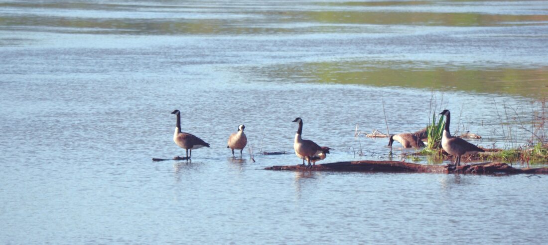
Geese stand on an old log along the river downstream of Little Hocking. (Photo by Art Smith)
GW: Oct. 27th. — “Left our encampment a quarter before seven; and after passing the creek near which we lay, and another of much the same size and on the same side.”
(This would be Duck Creek, which would indicated that they came down the western, or Ohio side of Buckleys Island, since he would have been unable to see the creek if he had came down the back side of the island. Duck Creek flows mainly north, with I77 frequently following the valley north.)
GW: “Also an island about two miles in length, but not wide, we came to the mouth of Muskingum, distant from our encampment about four miles. This river is about one hundred and fifty yards wide at the mouth; it runs out in a gentle current and clear stream, and is navigable a great way into the country for canoes.”
(It is actually 111 miles long and is navigable today thanks to a lock and dam system built in the 1800s and still maintained. Washington at this point was passing by the point where Marietta would be established 18 years later.
He later said of the area – “No colony in America was ever settled under such favorable auspices as that which has just commenced at the Muskingum (River). … If I was a young man, just preparing to begin the world, or if advanced in life and had a family to make provision for, I know of no country where I should rather fix my habitation.”)
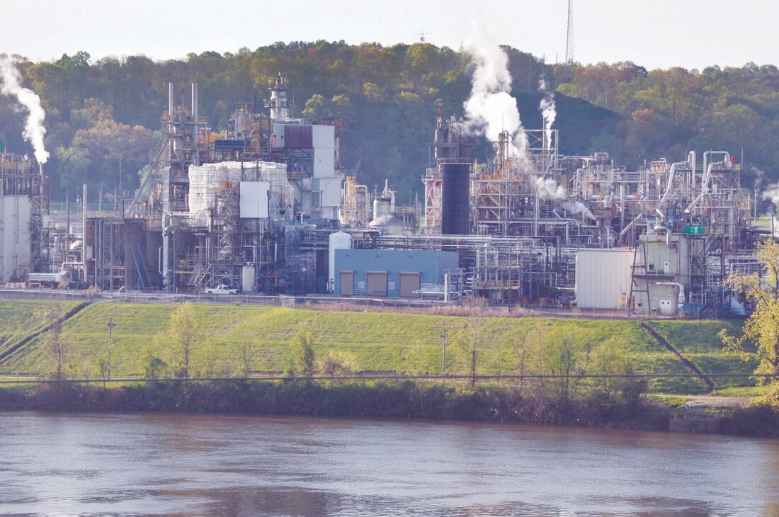
The large industrial complex built by DuPont in Washington, W.Va. (Photo by Art Smith)
G.W.:”From Muskingum to the Little Kenhawa is about thirteen miles. This is about as wide at the mouth as the Muskingum, but the water much deeper. It runs up towards the inhabitants of Monongahela, and according to the Indians’ account, forks about forty or fifty miles from the mouth, and the ridge between the two prongs leads directly to the settlement.”
(At this point he was where Parkersburg is today. The Little Kanawha is 169 miles long and starts in Upshur County. The upper parts of the river are not suitable for larger boats since the river is not controlled by dams, it is popular with kayakers however.)
G.W.: “To this fork, and above, the water is navigable for canoes. On the upper side of this river there appears to be a bottom of exceedingly rich land, and the country from hence quite up to the Three Islands level and in appearance fine. The Ohio running round it in the form of a horse-shoe forms a neck of flat land (He is writing about Belpre here and the long curve the Ohio River makes around the area), which, added to that running up the second Long Reach aforementioned, cannot contain less than fifty thousand acres in view”.
“About six or seven miles below the mouth of the Little Kenhawa, we came to a small creek on the west side, which the Indians called Little Hockhocking (The Little Hocking); but before we did this, we passed another small creek on the same side near the mouth of that river, and a cluster of islands afterwards (The cluster was at that time five islands. By 1900 silt had connected the five together to form the Blennerhassett Island that we know today.) The lands for two or three miles below the mouth of the Little Kenhawa on both sides of the Ohio appear broken and indifferent; but opposite to the Little Hockhocking there is a bottom of good land, through which there runs a small watercourse. I suppose there may be, of this bottom and flat land together, two or three thousand acres.”
(Washington would end up owning around 10,000 acres here. Nearly two centuries later Washington Bottom would become home to the huge DuPont facility that still occupies part of the land. The Little Hocking River is slightly downriver from Dupont.)

Grass reflects in the water along the bank of the Ohio River near Little Hocking. (Photo by Art Smith)
G.W.:”The lower end of this bottom is opposite to a small island, of which I dare say little is to be seen when the river is high”.
(This would be Mustapha Island. It is still there.)
G.W.: “About eight miles below Little Hockhocking we encamped opposite to the mouth of the Great Hockhocking, which, though so called, is not a large water; though the Indians say canoes can go up it forty or fifty miles.”
(People still canoe and kayak along the 102-mile long river. The community of Hockingport, largely made up of recreational vehicles, surrounds the confluence of the Hocking and Ohio rivers.)
Washington’s trip would continue until he reached the “Kenhawa” – He would venture up the Kanawha. Current day Huntington, and Ashland, Kentucky, are located at the mouth of the river for a ways and hunted buffalo and deer, before reversing and traveling back up the Ohio River to Fort Pitt. He returned to his Mount Vernon on Dec. 1, nine weeks and one day after leaving.
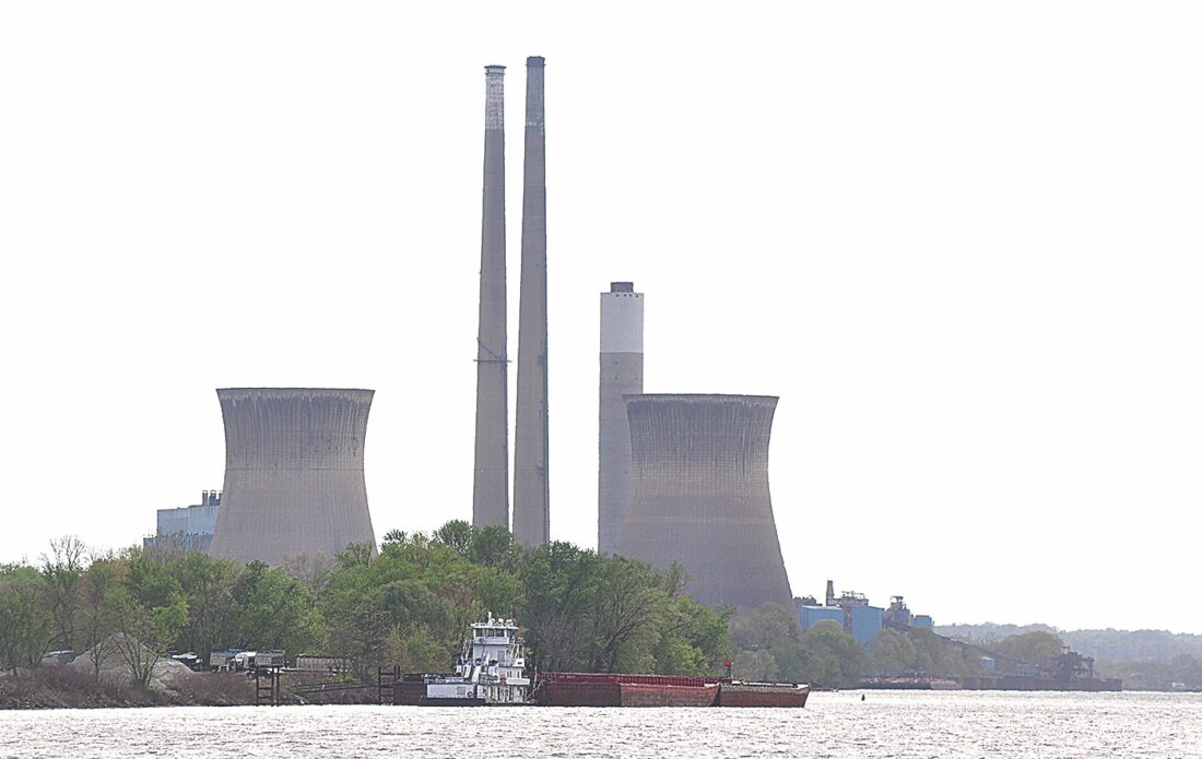
The large power plant along the river at Willow Island near Newport is one of many located along the river. (Photo by Art Smith)
Blennerhassett Island, which in 1770 was a series of smaller islands, is now a state park. (Photo by Art Smith)
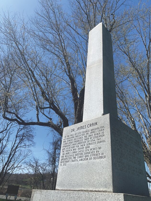
A monument to Dr. James Craik, who travel with Washington, is near Belleville, W.Va. (Photo by Art Smith)
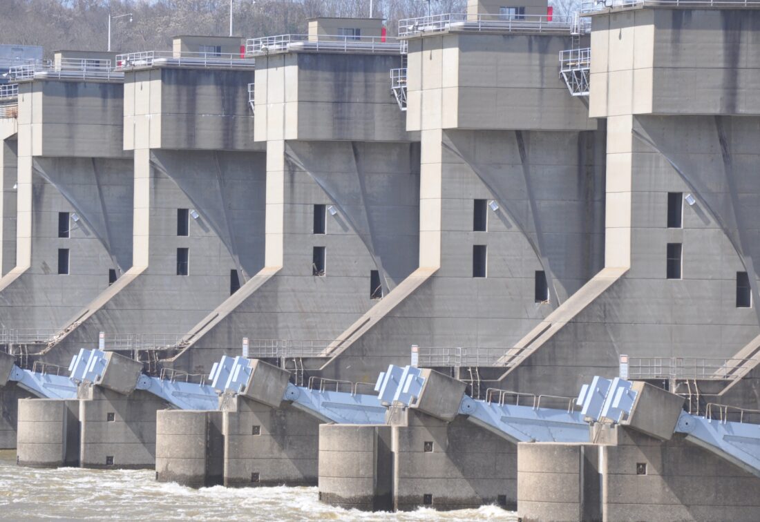
The Belleville Dam and others keep the Ohio River navigable by maintaining a minimum pool level. (Photo by Art Smith)
Local Columns
Listen to the scientists
MOV Climate Corner By Randi Pokladnik I was born in 1955, at a time when the USA was entering a new age of ...
It’s not over yet
Viewpoint By Hillary Royster In November 2025, I became a member of Washington County for Safe Drinking Water ...
Kidnapped!
God never intended for everyone to do what they see fit
By Mark Wilmoth Five hundred years before Christ, the city of Athens, Greece, birthed the world’s first known ...
Get out of your comfort zone
Viewpoint Greg Kozera Friday evening in Istanbul, Turkey. The Shale Crescent USA Team was part of a U.S. ...