Farmer’s Castle shielded early Belpreans from dangers
-
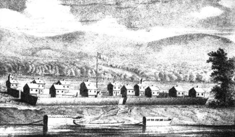
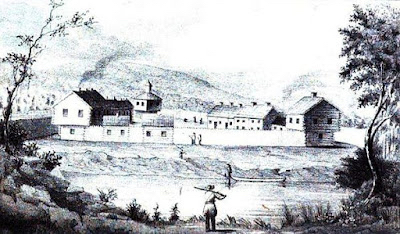
- (Photo provided) A drawing of the Farmer’s Castle that was included in S.P. Hildreth’s “Pioneer History: Ohio Valley and the early settlement of the Northwest Territory,” published in 1848.

(Photo provided) A drawing of the Farmer’s Castle that was included in S.P. Hildreth’s “Pioneer History: Ohio Valley and the early settlement of the Northwest Territory,” published in 1848.
Those establishing Marietta in 1788 felt the need to expand beyond the confluence of the Ohio and Muskingum rivers. As more people arrived aboard the stream of flatboats coming down the river, new settlements were created to provide homes and farmlands for the growing population.
The entire area was still a bit of a danger zone for those newcomers because the Native Americans who had lived here for centuries were not thrilled about New Englanders taking over the area.
The first settlements created remain the largest two communities in Washington County outside of Marietta.
Heading up the Muskingum, a large number of people began farming the area that would eventually become Beverly and Waterford. Following an attack in January of 1791 on a group of people at Big Bottom near current day Stockport, everyone in the new settlements needed to find a safer place to live.
On the Muskingum they constructed Fort Frye to guard against attacks. The name lives on through the school system that would later be named for the fort.
In Belpre, a “castle” was constructed to do the same thing. The Farmer’s Castle would provide a secure home to dozens of people, who until that point had lived in cabins up and down the river. The families met after the attack at Big Bottom and decided to quickly build a fortification to protect the residents.
Unlike Europe, from which the new Belpreans had descended, there were no castles in Ohio, or anywhere else in the newly opened Northwest Territory. There were, however, millions of trees, and it was from these that they constructed their version of a castle.
Two-story block houses were constructed in a group near the banks of the Ohio River. A total of 13 block houses were built arranged in two rows with a wide street between them. Pickets made from 14-foot logs between each house made for a defensible community. Gates were closed each night around the 80 rods by 6 rods (1,320×99 feet) fortress.
Families began moving into the block houses as soon as they were completed. At dusk the domesticated animals would be herded through the gates, and the gates closed. Watch towers at the corners were eight feet higher than the other roofs and constantly manned.
The group named the fortress Farmer’s Castle because that is what they were. The residents were always in danger when tending crops outside the walls and were at constant risk of attacks. Later two other fortifications were built so that the people could live closer to their fields.
One of them was six miles below “The Castle” at Newbury and was the site of a brutal murder after a woman ventured outside the stockade to plant a few fruit trees. She was murdered along with one of her two children. A gravely injured infant survived.
There were many families living in different homes within the stockades, some with as many as 10 children. According to S.P. Hildreth’s “Pioneer History: Ohio Valley and the Early Settlement of the Northwest Territory,” there were more than 130 children living there by 1792. In many cases multiple families would share a single house of the “castle.”
The treaty of Greenville finally brought peace to the valley, and the farmers were able to move from the “castle” in 1796.
Today you will find little evidence of the stockade. A stone marker along the edge of a church parking lot along Washington Boulevard near the city limits notes that the structure once stood south of the location along the Ohio River. The location is now occupied by small homes and a mobile home park.
Art Smith is online manager of The Marietta Times and The Parkersburg News and Sentinel, he can be reached at asmith@mariettatimes.com
Local Columns
Nineteenth Amendment to the Constitution
The Nineteenth Amendment to the U.S. Constitution, the Women’s Suffrage Amendment, prohibited the United States ...
Now is the time, tomorrow may be too late
By Mark Wilmoth In her book, No Ordinary Time, author Doris Kearns Goodwin tells about Franklin Roosevelt’s ...
John Miller, man without a country
MOV Climate Corner: Yes, WE are the problem
I’ve been voraciously consuming content on climate change and related phenomena (books, articles, documentaries, ...
Farmer’s Castle shielded early Belpreans from dangers