
Weather expected to be calm in weekend as some Doddridge, Pleasants residents remain without power
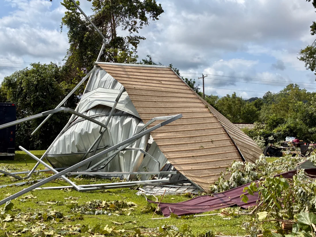
A tornado cut through mobile homes and travel trailers at Riverview Estates Tuesday in Pleasants County, flipping trailers, snapping trees and power lines, and ripping up car ports. (Photos by Steven Allen Adams)

A crew from the West Virginia Division of Highways cleaned debris Wednesday on West Virginia 16 a few miles from St. Marys where strong winds on Tuesday toppled trees, blocked roads and damaged structures and utility lines. (Photo by Jess Mancini)
A tornado cut through mobile homes and travel trailers at Riverview Estates Tuesday in Pleasants County, flipping trailers, snapping trees and power lines, and ripping up car ports. (Photos by Steven Allen Adams)
A crew from the West Virginia Division of Highways cleaned debris Wednesday on West Virginia 16 a few miles from St. Marys where strong winds on Tuesday toppled trees, blocked roads and damaged structures and utility lines. (Photo by Jess Mancini)
Trending
PARKERSBURG - Pleasant and Doddridge counties are expected to receive a break from severe weather over the next several days following storms that brought tornadoes and heavy rainfall to the region earlier this week.
Joe Curtis, a meteorologist with the National Weather Service in Charleston, said sunny and quiet conditions are expected through at least Saturday. The earliest opportunity for another thunderstorm is Sunday, though a better chance for widespread storms is expected Monday.
"As of right now, it doesn't look like it will be a similar intensity," Curtis said. "But that could change over the next few days as things become more clear."
According to a public information statement issued Wednesday evening, National Weather Service personnel surveyed portions of southeastern Ohio and northern West Virginia and confirmed at least two tornadoes. Both began in Washington County and moved east into Pleasants County. One continued seatheast into Doddrige County along a noncontinuous path.
The statement said the tornadoes' exact strengths, widths and track lengths were still being evaluated and would be released later. According to Jennifer Berryman, a meteorologist with the weather service, the results could take a few days.
Heavy rainfall also accompanied Tuesday's storms, according to a separate statement released late Wednesday by the weather service. The report compiled rainfall that was 1 inch or greater on Tuesday, with reports submitted by weather stations and volunteer observers.
Five locations in Doddrige County recorded between 2.51 and 3.45 inches of rain. The highest county total was 3.45 inches near Auburn, followed by 3.28 inches northeast of West Union, 3.17 inches southeast of West Union and 2.93 inches near Center Point.
In Wood County, an observation site near Williamstown recorded 2.97 inches, while the Mid-Ohio Valley Regional Airport recorded 1.93 inches.
The weather service noted that the observations were collected from several sources using different equipment and that not all the listed data was considered official.
Curtis said Wood County should also experience quiet weather over the next several days. A small chance of storms is possible Sunday, with a greater opportunity for thunderstorms Monday. He also stated it is too early to determine exactly how strong Monday's storms could become, but current forecasts do not indicate conditions as severe as those experienced earlier this week.
Doddridge County Emergency Management Director George Eidel said officials were continuing to assess damage across the county following Tuesday's storms.
Some residents had water in their basements, but Eidel said he had not received reports of major losses inside homes due to water. He cautioned that he had not been able to survey the entire county.
Emergency personnel were working in the area where the tornado struck, Eidel said. Debris, downed utility lines and blocked roads remained the county's largest concerns.
"Our biggest thing right now is getting the power back up and the roads opened up," he said.
Eidel said the county's emergency management department would advise those seeking updates on power restoration to check for live updates at www.outages-mdwv.firstenergycorp.com.
As of Tuesday evening, 769 customers in Doddridge County remained without power, according to First Energy's outage map. There were 740 in Pleasants County, which appeared to bear the brunt of the tornadoes' damage. In Ritchie, Tyler and Wetzel counties, there were 175, 151 and 44 customers without power, respectively. Estimated restoration times ranged from Thursday night to Friday afternoon.
Gwen Sour can be reached at gsour@newsandsentinel.com.