Snowed in, shovels out: Mid-Ohio Valley greeted Sunday morning with snow, ice
Mid-Ohio Valley greeted Sunday morning with snow, ice
-
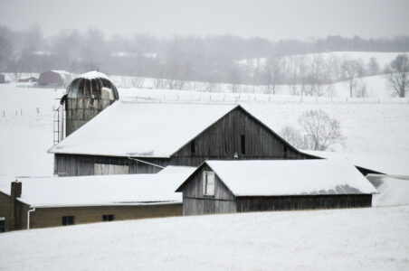
- (Photo by Art Smith) Snowy fields and farms in western Washington County.
-
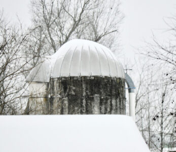
- (Photo by Art Smith) Snow covers the domed top of a silo near Watertown following the heavy snow overnight Saturday into Sunday.
-
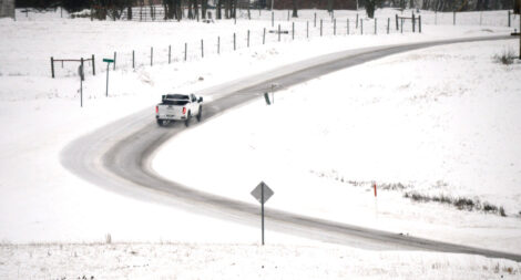
- (Photo by Art Smith) A truck makes its way toward Marietta on Ohio 676 following the heavy snow Sunday.
-

- (Photo by Art Smith) A family in a side-by-side travel a snow-covered Klinger Road Sunday morning.
-

- (Photo by Art Smith) Steps leading to an apartment illustrate the depth of the snowfall in Watertown.
-
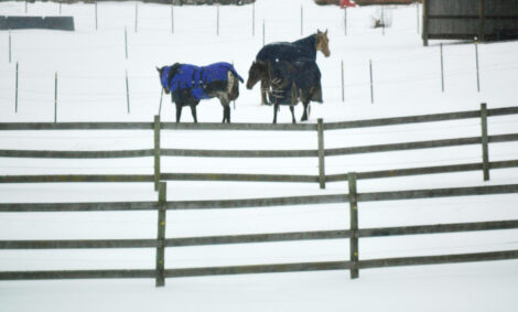
- (Photo by Art Smith) A trio of horses at Cherry Creek Equestrian at Ohio Routes 676 and 339 contrast with the freshly fallen snow.
-

- (Photo by Terry L. Estep) Snow covers 11th Street in Parkersburg on Sunday morning.
-

- (Photo by Terry L. Estep) Show covers bricks near Juliana Street in Parkersburg on Sunday morning.
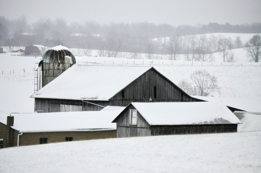
(Photo by Art Smith) Snowy fields and farms in western Washington County.
Bitter cold and a complex winter storm system moved into the Mid-Ohio Valley this weekend, prompting closures, cancellations and heightened preparedness by emergency officials.
The National Weather Service reported hazardous winter weather conditions from the storm that began late Saturday night and greeted residents with snow and ice Sunday morning.
On Sunday, the Washington County Sheriff’s Office upgraded from a level two to a level three snow emergency due to hazardous driving conditions as snow and ice continued to fall throughout the day. A level three snow emergency closes roads to non-emergency personnel and only if deemed necessary should residents travel.
The Ohio State Highway Patrol Marietta Post also reported no weather related accidents as of noon Sunday. Roads were being cleared.
The Wood County 911 Center reported no weather-related incidents, but said dispatchers and first responders were prepared should conditions deteriorate as the storm progresses.
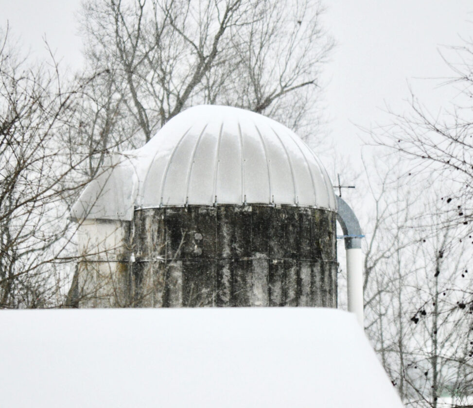
(Photo by Art Smith) Snow covers the domed top of a silo near Watertown following the heavy snow overnight Saturday into Sunday.
The West Virginia Department of Transportation said engineers know how to prepare when it comes to frigid temperatures and salting the roadways.
“When we experience ice instead of snow, we use similar means and materials to remove it,” said state Highways Engineer Jake Bumgarner.
Salt becomes less effective and it takes longer to melt the ice in lower temperatures, he said. Bumgarner said they were concerned about the refreeze Sunday night and how that would impact the effectiveness of the salt.
“What makes treating ice harder than snow is that the ice itself accumulates quicker,” Bumgarner said. “Ice also doesn’t leave as many visual cues. A road may look clear and wet, but be very slick from ice.”
Residents also were warned to be cautious because roads could remain hazardous into this morning. Residents were urged to avoid traveling unless it was necessary.

(Photo by Art Smith) A truck makes its way toward Marietta on Ohio 676 following the heavy snow Sunday.
Across the region, some businesses closed early and multiple church services were canceled in anticipation of hazardous travel conditions.
Among those were The Arc of the Mid-Ohio Valley that canceled its Cabin Fever Fundraiser scheduled this weekend. The dance was moved to 6-10 p.m. Feb. 21 at the Parkersburg Art Center where all previously purchased tickets will be honored, the Arc said.
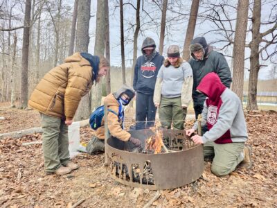
Despite the frigid temperatures and storm, Scouts held their Klondike Derby-style Gold Rush at Camp Kootaga on Saturday. Organizers said weather conditions were closely monitored with adjustments made to protect participants as temperatures dropped.
Event organizer and Scoutmaster Alan Campbell said the schedule was shortened, heated indoor spaces were opened and Scouts were encouraged to take frequent warm-up breaks. Leaders also encouraged the buddy system to help monitor each other for signs of exposure.
“Safety is really, really important to us, and we spent a lot of time watching the weather and thinking about how we could keep our group safe,” Campbell said.

(Photo by Art Smith) A family in a side-by-side travel a snow-covered Klinger Road Sunday morning.
The Weather Service in Charleston forecasted a mix of winter precipitation through the weekend, including snow, sleet, freezing rain and rain as warmer air pushed northward into the region.
According to the Weather Service, Southeast Ohio, Northeast Kentucky and Northern West Virginia experienced temperatures cold enough to support moderate to heavy snow, while parts of central and southern West Virginia experienced periods of mixed precipitation or rain before it continued to snow throughout the day on Sunday.
Precipitation is expected to diminish today, but upslope snow could persist along the West Virginia mountains into the night. Forecasters also cautioned moderate to major travel and infrastructure impacts are still expected across the region.
Appalachian Power reported around 16,000 of its customers without power as of noon Sunday. Nearly 3,000 workers were prepared to respond as road conditions improved.
According to the Appalachian Power Outage Map, more than 120 warming centers open to the public across West Virginia in the event of an extended outage.

(Photo by Art Smith) Steps leading to an apartment illustrate the depth of the snowfall in Watertown.
Appalachian Power recommended residents plan for weather events and potential outages by turning off large electric appliances that could overload the system.
Officials also recommended keeping a generator and an emergency kit with food, water, warm clothes and a flashlight nearby.
FirstEnergy Corp. said in a press release it has crews prepared for power outages due to ice or snow. Crews reported light, fluffy snow has less of an impact on power lines than heavy, wet snow and ice.
FirstEnergy Corp. also provided ways residents can be prepared for winter weather and what to do in the event of a power outage.
Visit https://www.firstenergycorp.com/mon_power.html and https://www.appalachianpower.com/outages/storms/details?id=95 for more information and real-time updates.

(Photo by Art Smith) A trio of horses at Cherry Creek Equestrian at Ohio Routes 676 and 339 contrast with the freshly fallen snow.
The utility reported 1,200 customers in West Virginia without power as of noon Sunday with 18 reported in Calhoun, Ritchie and Wood counties. Restoration was to be completed by Sunday afternoon.
The National Weather Service encouraged residents to report local weather conditions to help forecasters track rapidly changing precipitation types. Officials said public reports, referred to as “ground truth,” are especially helpful when snow changes to sleet or freezing rain.
Residents can submit reports through the mPING mobile app, online at the National Weather Service website or on social media by tagging the agency and including location and time details. Officials emphasized that safety should always come first and warned residents not to put themselves at risk to take measurements.
The West Virginia Emergency Management Division said residents seeking winter storm resources or information about warming shelters can contact WV 211 by dialing 211 or texting their ZIP code to 898-211.
Emergency officials continued to urge residents to limit travel when possible, stay warm and monitor forecasts as conditions evolve.
Staff reporter Gwen Sour contributed to this story.

(Photo by Terry L. Estep) Snow covers 11th Street in Parkersburg on Sunday morning.

(Photo by Terry L. Estep) Show covers bricks near Juliana Street in Parkersburg on Sunday morning.
Local News
Snowed in, shovels out: Mid-Ohio Valley greeted Sunday morning with snow, ice
O’Neill Center releases weekly activity schedule
The O’Neill Center activity schedule for the week of Jan. 26-30: Monday, Jan. 26 - 10 a.m. – Chair Exercise; ...
Scouts brave cold weather during Klondike Gold Rush event at Camp Kootaga

Recognizing hard work: WCCC names January Students of the Month

Parkersburg Area Community Foundation celebrates over six decades of community support