‘Flood of Record’
The Mid-Ohio Valley prepares for high waters from recent storms
-
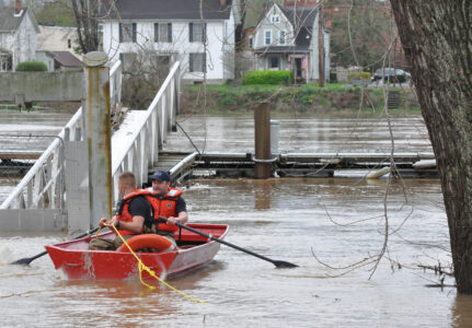
- Marietta Fire Department’s Capt. Eric Moore and firefighter Dan Hammer use a small boat to reach the city docks behind the Armory on Front Street Wednesday morning. The pair were on their way to the city’s fireboat that was tied up at the dock. The department removed the fireboat from the river because high water would have made it impossible to take the boat under the Historical Harmar Village Bridge if there was an emergency on the Ohio River. (Photo by Art Smith)
-
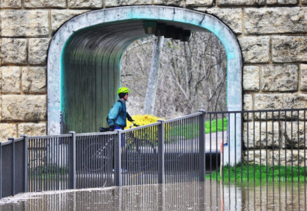
- A cyclist turns around after riding through the tunnel under the Putnam Bridge in Marietta Wednesday morning. The flooding Muskingum River covered the area behind the post office and Armory on Front Street. (Photo by Art Smith)
-
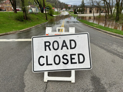
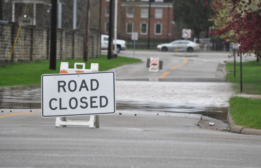
- A road closed sign on Hart Street warns drivers of a flooded street. (Photo by Art Smith)
-

- A car sits surrounded by water in a parking lot behind the Marietta Post Office Wednesday morning. (Photo by Art Smith)
-

- Water surrounds a sign for the appropriately named River Trail along Ohio Street. (Photo by Art Smith)
-

- Water covers South Sixth Street next to Don Drumm Stadium Wednesday morning. (Photo by Art Smith)
-
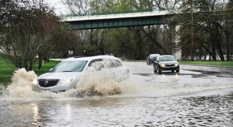
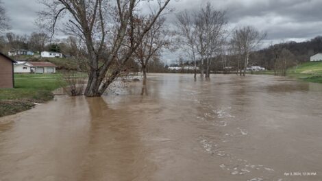
- Traffic on Gilman Avenue drives through water from the Muskingum River Wednesday morning to get onto the Washington Street Bridge. Most parts of Gilman Street were later closed as water continued to rise. (Photo by Art Smith)
-
- Duck Creek is shown flooding in the Olive area of Noble County Wednesday. (Photo provided)
-
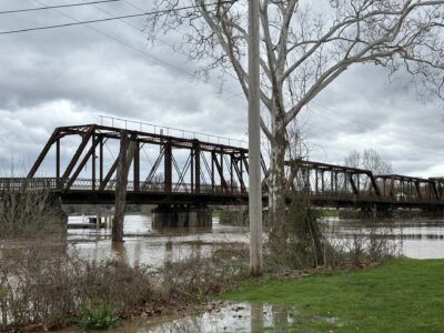
- The Harmar Bridge can be seen with the Muskingum River rising slowly beneath it and approaching an area of land near the Marietta Armory parking lot on Front Street Wednesday afternoon. (Photo By Michelle Dillon)
-

- The Ohio River creeps up to Ohio Street, covering portions of Ohio Riverfront Park Wednesday. The water level was measured as 36.81 feet at 3 p.m by the National Weather Service. The flood level is 35 feet. (Photo by Kristen Hainkel)

Marietta Fire Department’s Capt. Eric Moore and firefighter Dan Hammer use a small boat to reach the city docks behind the Armory on Front Street Wednesday morning. The pair were on their way to the city’s fireboat that was tied up at the dock. The department removed the fireboat from the river because high water would have made it impossible to take the boat under the Historical Harmar Village Bridge if there was an emergency on the Ohio River. (Photo by Art Smith)
MARIETTA – Mid-Ohio Valley residents and businesses prepared for high water Wednesday as flooding from Tuesday’s storms have caused the banks of many water ways to spill over.
Washington County Sheriff Chief Deputy Mark Warden said the sheriff’s office already has a list of high water locations.
‘It’s pretty lengthy,” Warden said of the list.
Warden said as of 2 p.m. Wednesday there were 29 roads on the high water list, including Gilman Avenue in Marietta, Main Street in Macksburg and State Route 60 at Cat’s Creek Road in Lowell.
Mayor Josh Schlicher said Front Street was closed to through traffic around noon Wednesday to allow businesses to prepare for high water. He said the hope would be to reopen the road by today but that would depend on new information of where the river is expected to crest.

A cyclist turns around after riding through the tunnel under the Putnam Bridge in Marietta Wednesday morning. The flooding Muskingum River covered the area behind the post office and Armory on Front Street. (Photo by Art Smith)
Ted Dobbin, mayor of Macksburg, said they were dealing with high water in the village but there were no injuries or major property damage.
“Every time we have water like this it is up and down, but there may be some property damage,” he said. “Right now, there are no houses involved and nobody is stranded by the water; it’s just up and down.”
Dobbin said Main Street was closed as were the lower sections of Dilly and Fourth streets.
Part of the problem in Macksburg stems from the strip mining operations that took place in the area many years ago, Dobbin said.
“Back then they didn’t care what they did and the dirt slid into the creeks, plugged them up and the water had nowhere to go,” he said. “Today they are more careful.”
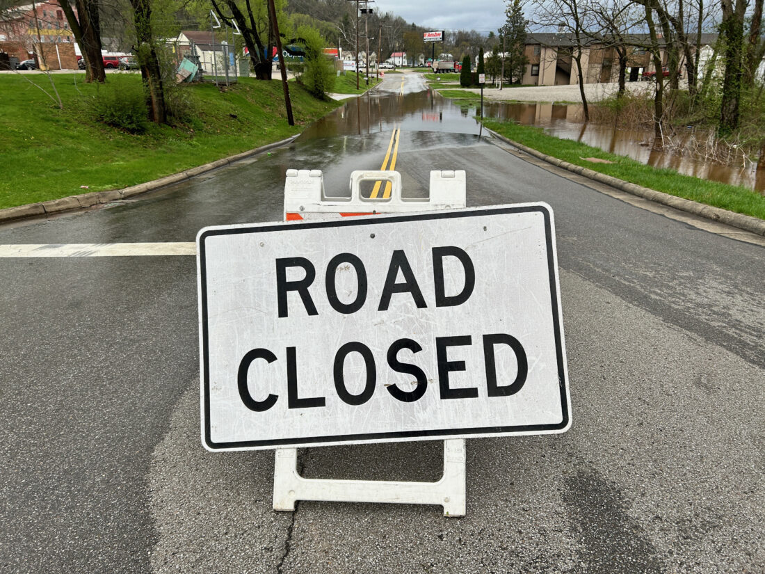
A road closed sign on Hart Street warns drivers of a flooded street. (Photo by Art Smith)
Warden asks that the public really adhere to road closing signs. He said earlier in the day the sheriff’s office helped a vehicle that had stalled out because it drove through high water on Gilman Avenue.
“Unfortunately this time of year (flooding) is a way of life sometimes,” Warden said.
He said it was getting harder to get out of the city by Wednesday afternoon due to Gilman Avenue and Virginia Street being closed and traffic being routed to State Route 7.
A media release from Washington County Commissioner James Booth said the Ohio River is projected to crest at 40.5 feet at 8 p.m. today.
“Please take this time to know your flood levels for your area and make plans in case you have to evacuate,” Booth said in the release. “Never attempt to drive through high water or walk through high water. Some roads are already closed with high water.”

A car sits surrounded by water in a parking lot behind the Marietta Post Office Wednesday morning. (Photo by Art Smith)
Booth said the commission will be making frequent updates and that can be found on the Washington County Local Emergency Planning Commission’s Facebook page and the Washington County Sheriff’s Office Facebook page. Residents who have questions can call 740-373-5613.
The National Weather Service in Charleston issued flood warnings Wednesday for the Ohio River at Marietta, the Muskingum River at Beverly and Duck Creek at Macksburg.
An NWS representative said that Muskingum River cresting at 34.74 feet in Beverly was unusual.
“It did set a new all-time record,” the representative said.
He said the previous record was 33.2 feet on Feb. 18, 2022.
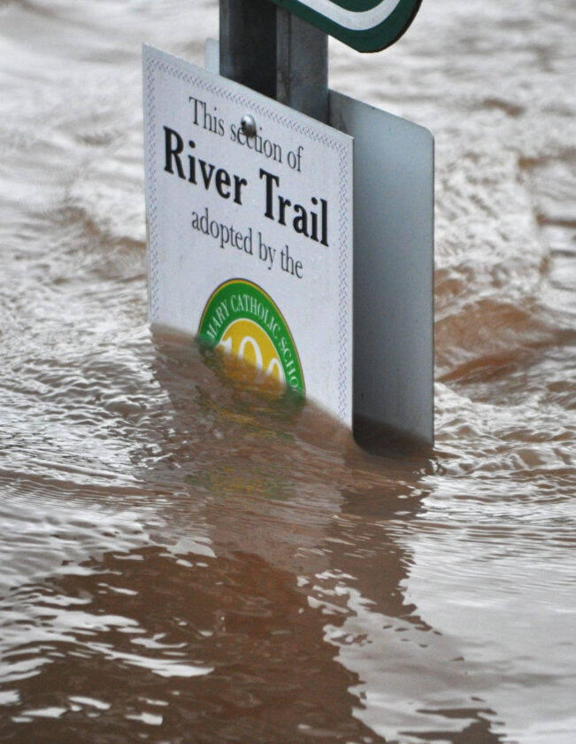
Water surrounds a sign for the appropriately named River Trail along Ohio Street. (Photo by Art Smith)
The flood warning said the Muskingum River is expected to fall below flood stage early this afternoon.
The NWS said the flood warning for Duck Creek at Macksburg will last until 8 p.m. today.
The warning said Duck Creek is flooding and continues to rise due to runoff from excess rainfall. It said the gauge at Duck Creek at Macksburg was at 14.75 feet at 10:34 a.m. Wednesday and is slowly rising.
Flood stage is 13 feet. It said some areas will experience flooding including Macksburg and Lower Salem.
Lower Salem resident Jared Lowe said the two main roads in town, Route 145 and Route 821, were closed.
Water covers South Sixth Street next to Don Drumm Stadium Wednesday morning. (Photo by Art Smith)
He said he wasn’t surprised by the flooding.
“This is not unusual. We’re right next to Duck Creek. It typically floods once or twice a year here,” he said.
Beverly Mayor Jim Ullman reported road closures, flooding in several sports fields and a local coffee shop.
Ullman said Third Street was closed due to flooding and caused coffee shop Lock No. 4 Coffee to close. The business posted pictures on their Facebook page, showing water up to the front door and into the store lobby.
Ullman said Fort Frye Local Schools closed due to flooding.
The river covered the school’s practice football field, baseball and softball fields.
Frontier Local Schools were also closed Wednesday, along with Pleasants, Tyler and Wetzel County schools in West Virginia.
Ullman said State Route 60 between Beverly and Lowell was also closed on Wednesday.
The forecast for the rest of the week said an upper level low will sustain chances of precipitation through the end of the work week and temperatures will trend cooler over the next several days, with rain expected to transition to snow along the mountains by Wednesday night.
It said snow accumulation is expected to continue over higher terrain through Friday and a brief sting of drier weather is expected to arrive for the weekend before the next system looms for the state of the next work week.

Traffic on Gilman Avenue drives through water from the Muskingum River Wednesday morning to get onto the Washington Street Bridge. Most parts of Gilman Street were later closed as water continued to rise. (Photo by Art Smith)

Duck Creek is shown flooding in the Olive area of Noble County Wednesday. (Photo provided)

The Harmar Bridge can be seen with the Muskingum River rising slowly beneath it and approaching an area of land near the Marietta Armory parking lot on Front Street Wednesday afternoon. (Photo By Michelle Dillon)
The Ohio River creeps up to Ohio Street, covering portions of Ohio Riverfront Park Wednesday. The water level was measured as 36.81 feet at 3 p.m by the National Weather Service. The flood level is 35 feet. (Photo by Kristen Hainkel)
Local News
Artsbridge Calendar of Events
Artsbridge Calendar of Events April 21-27: Today: Art Exhibit, Diane Wigal Wildlife Photography, 9 a.m. to 4 ...
Local events
Meetings ¯ The next meeting of the Frontier Local Economic Development Association scheduled for today has been ...

States — including Ohio — win monopoly suit against Live Nation, Ticketmaster

Ham Radio Open House a big success
Around Town
FLEDA meeting cancelled The next meeting of the Frontier Local Economic Development Association scheduled for ...
Memorial Health to host primary care community discussion
The Memorial Health Foundation will host a community event next month to explore how relationships between patients ...