Ohio Fever

Scan to learn more about late 1700s pre-statehood Ohio.
Have we got a deal for you! Today we are bombarded with telemarketing calls and events or people that go viral. In the late 1700’s, land in the “Ohio Country” was an attraction and curiosity to people living in the colonies. Sometimes it was called “Ohio Fever.” The Ohio Country then included the Ohio River Valley and tributaries from western Pennsylvania into present day Ohio. Descriptions of the Ohio lands were grandiose, sometimes misleading, often amusing. They rarely mentioned disadvantages.
An early promoter of the Ohio Country was George Washington. He was passionate about the future potential for the Ohio Valley and purchased several large parcels in the 1770’s on the West Virginia side of the Ohio River between Parkersburg and Point Pleasant. He advertised the land as: “…the cream of the country in which they lye (sic), being the richest interval lands on the two rivers…(and) are unquestionably among the most valuable on the Western waters…”
Manasseh Cutler, who helped negotiate the purchase of land for Marietta’s settlement, wrote a booklet in 1787 describing land in the area. It was a masterpiece of marketing, though flawed with many inaccuracies. Some his points are listed below.
–The booklet begins with a certification by noted geographer Thomas Hutchins: “I do certify, that the facts therein related…are judicious, just and true.”
— Indian land claims were described as “extinguished” by treaties. Not true.
–The Ohio River flows clear to the Mississippi River, through “delightful and fertile country.” More than 9 tributaries of the Ohio River are listed as navigable for at least 100 miles.
–“The Muskingum is a gentle river, confined by its banks so high as to prevent its flooding,..250 yards wide at its confluence with the Ohio.” We know the river was not flood proof. Curiously, confluence is a term we use today.
— Rivers were then a primary transportation mode. Cutler listed 4 different routes which connected the Ohio Country with the eastern colonies or the ocean: Down the Ohio River, up the Ohio into Pennsylvania, the Kanawha River into Virginia; and up the Muskingum River eventually to Lake Erie. This helped dispel any impression that this interior area away from oceans was isolated in any way.
— The Hocking River was said to contain iron ore, lead, coal, and salt springs with an “inexhaustible” supply of salt, white and blue clay “of excellent quality” suitable for making glass and pottery. That part seems accurate; glass and pottery plants have been major industries in that valley.
–River valley lands “afford as rich a soil as can be imagined and may be (farmed) with very little labour.” Soil is suitable for many crops. Cotton grows naturally “in great perfection.” This is clearly inaccurate.
–Grapes are abundant, suitable for “rich red wine.” Maybe in a few spots, but it’s not Bordeaux here.
–Virgin forests with huge trees offer abundant timber. General Parsons measured a sycamore 44 feet – large enough for people to stand inside.
–M. St. John de Crevecoeur, a French consul, wrote about the Ohio Country. He claimed that farming there was easy “…scratch the surface of the earth, deposit your rye, your corn, your potatoes, your cabbages, your tobacco, etc., leave the rest to nature; and (then) amuse yourself with fishing and hunting.” What a life, eh? But he cautioned, better “obtain permission from Indians of the neighboring villages” first.
The reference to Indians points out the disadvantages of early frontier life, often ignored in the marketing literature. People moving to the area had to cope with disease, Indian threats, lack of infrastructure, limited arts and culture, and leaving behind family and friends. Fortunately, many adventurous souls moved west, eventually creating five states with millions of people. It’s a heritage we can be proud of.
Features
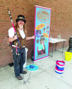
Veteran John Gradwohl brings Navy skills to stage, bubble shows
Green beans: A standard for the home garden
Hello Mid-Ohio Valley gardeners and farmers! The first week of June brought us some beautiful weather for working ...
Backyard Gardener: Shade Tree Selection
Hello Mid-Ohio Valley farmers and gardeners! We were a little on the dry side but that has all changed this week. ...
It’s tough to be a young adult!
In the twenties, humans develop their sense of personal identity, set some of their goals for life and begin to ...

Hunting and fishing in early Marietta
The challenge to forgive and overcome evil with good
An old Chinese proverb says, “One who pursues revenge should dig two graves.” Anger and the accompanying desire ...